Services Hydrography Cartography Gallery SSS Data Data Processing Contact →
Survey · Positioning · Bathymetry
HYDROGRAPH LTD
// Hydrographic Survey & Marine Cartography

Measured Waters.
Safer Navigation.
Reliable Charts.

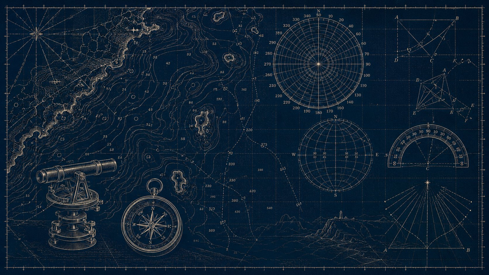
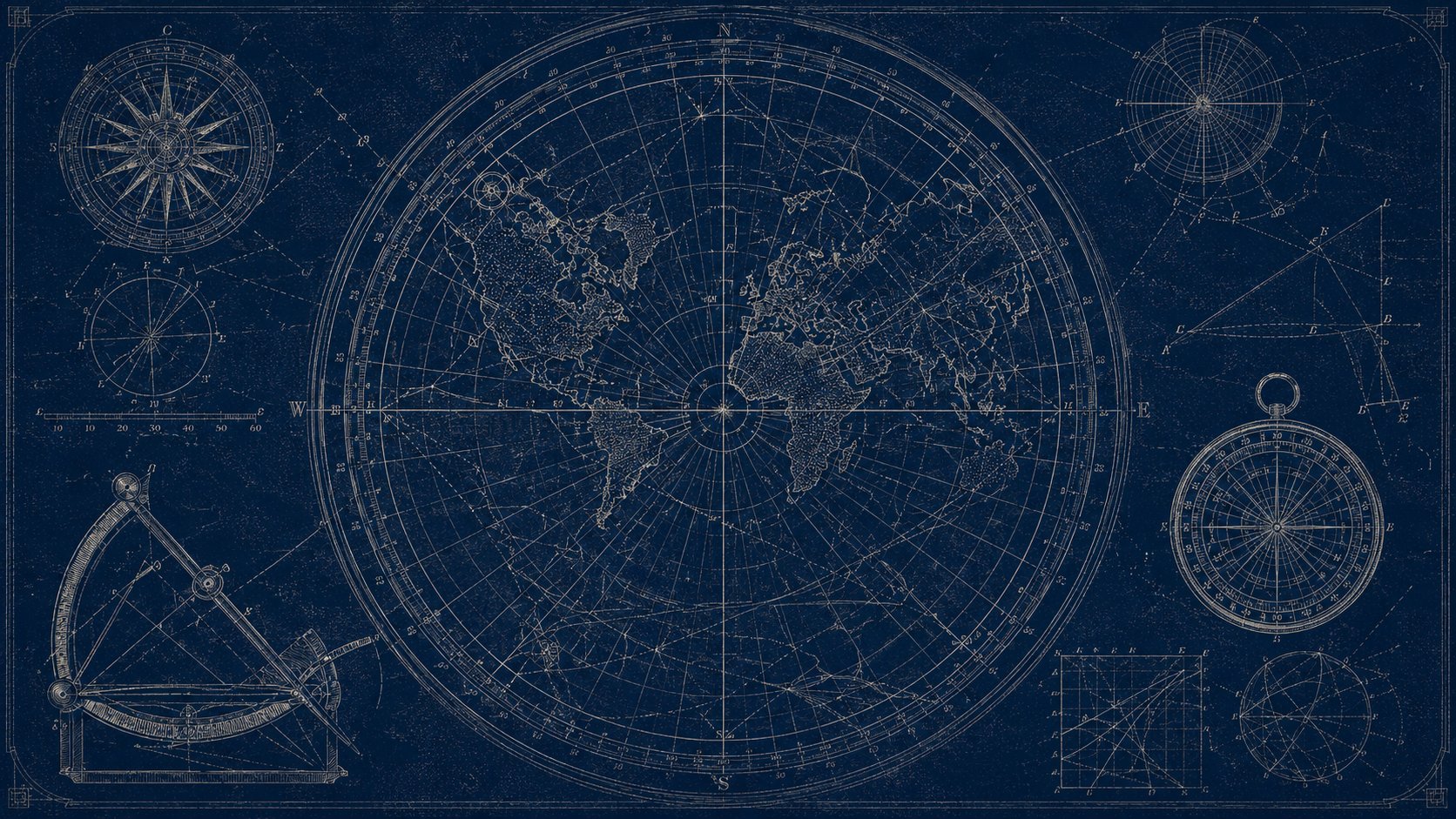
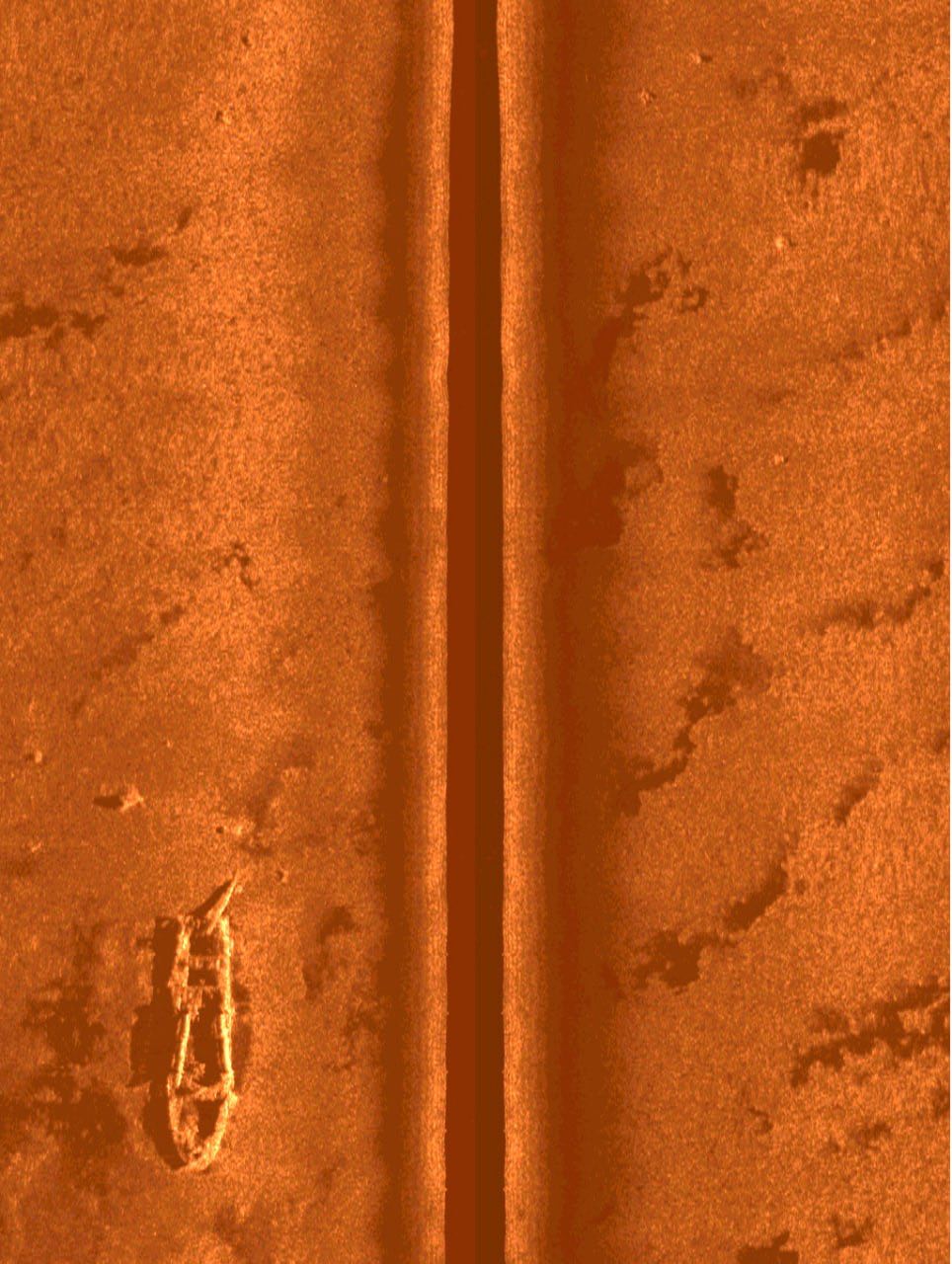
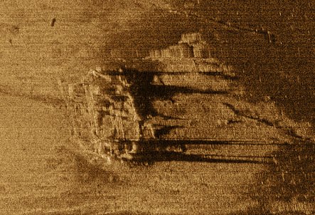
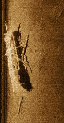
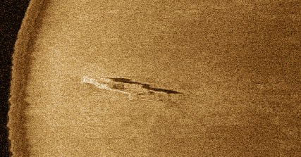
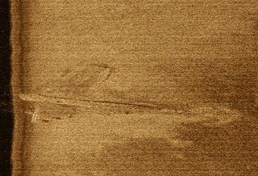
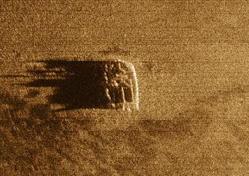
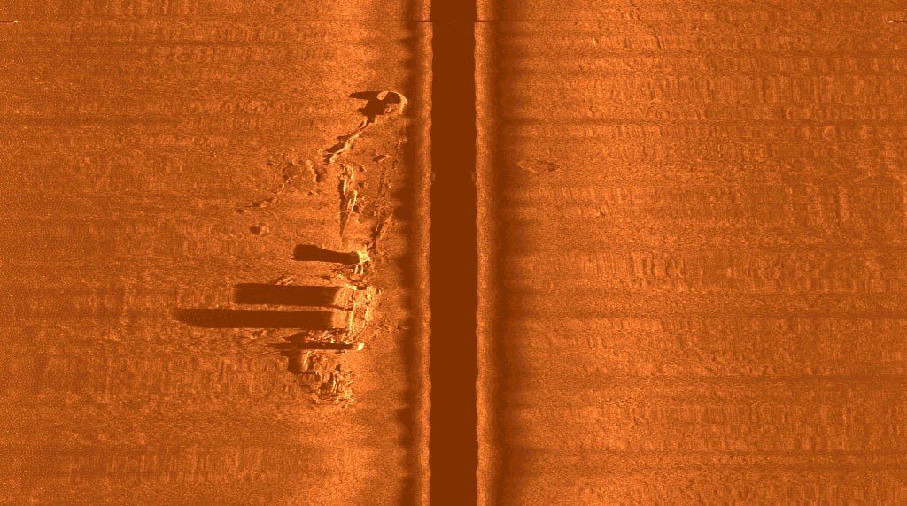
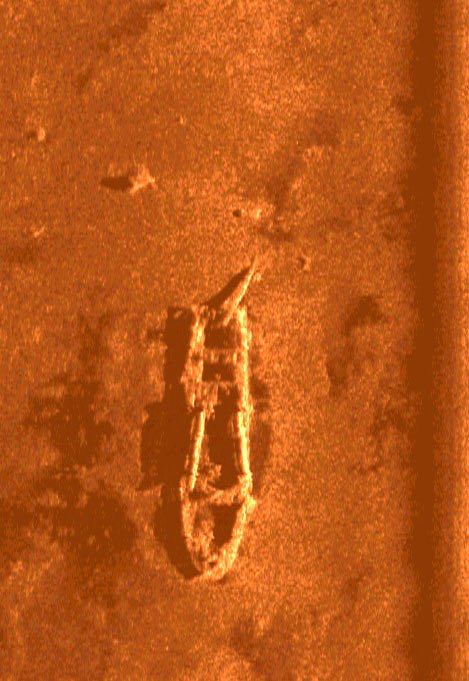
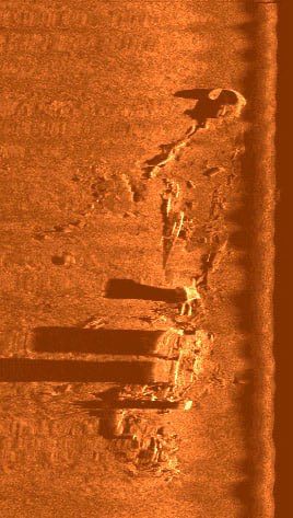
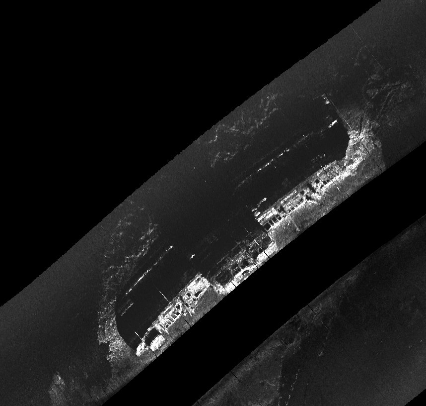
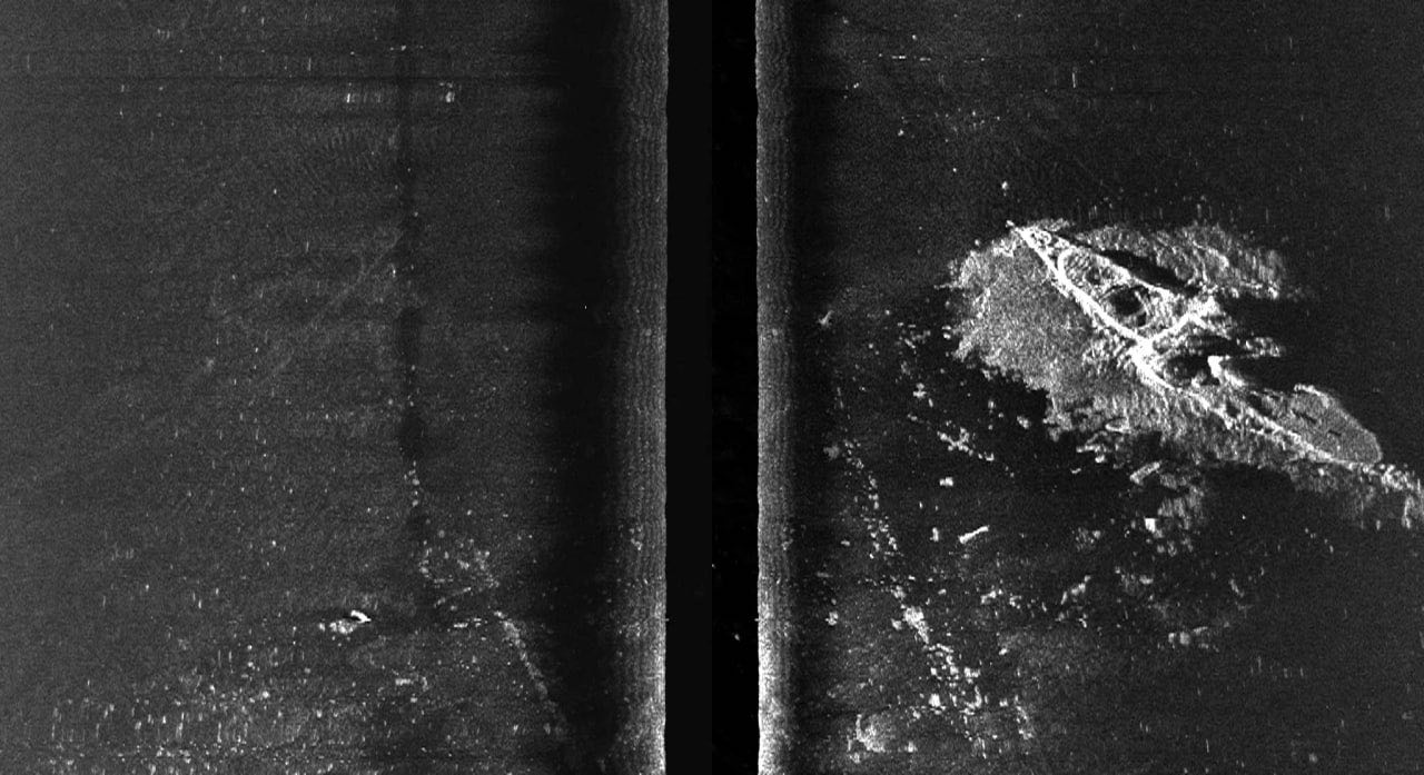
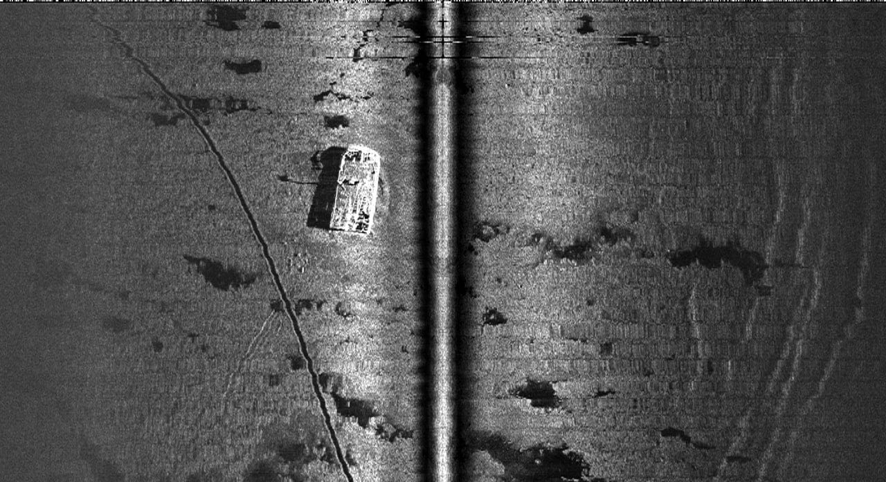
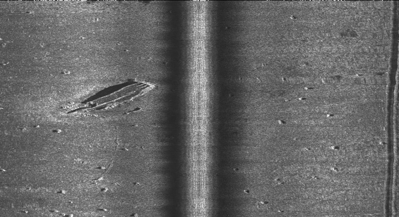
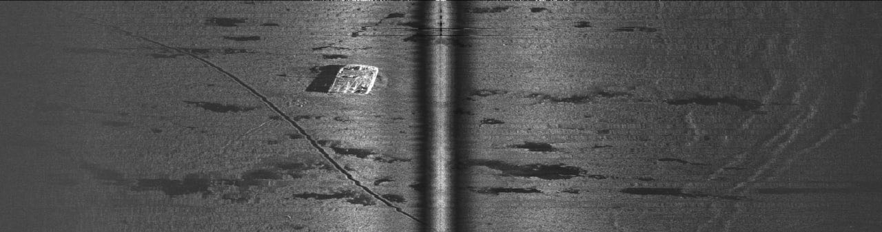
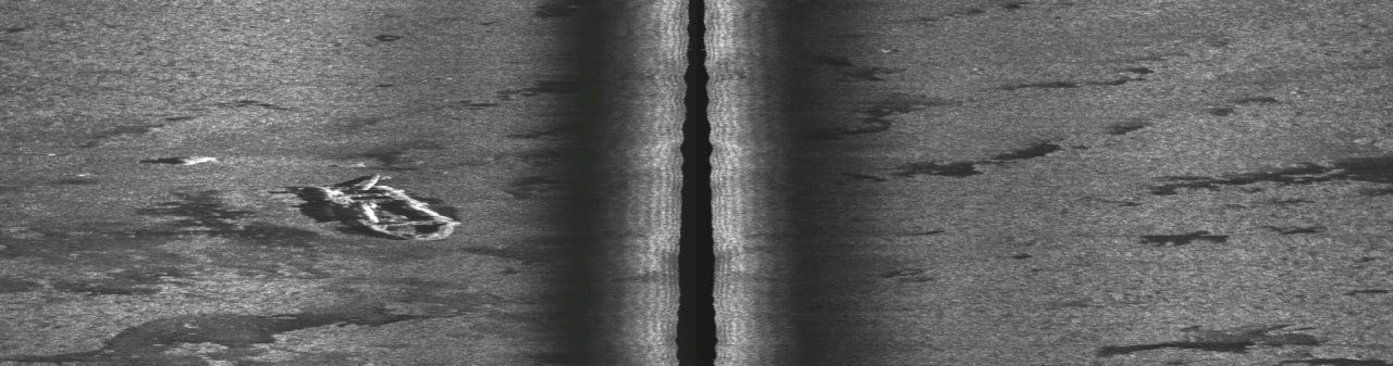
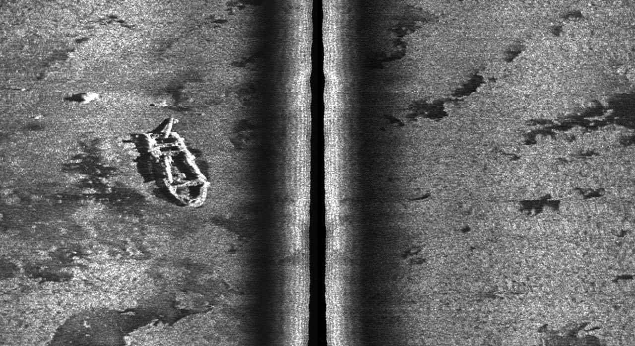
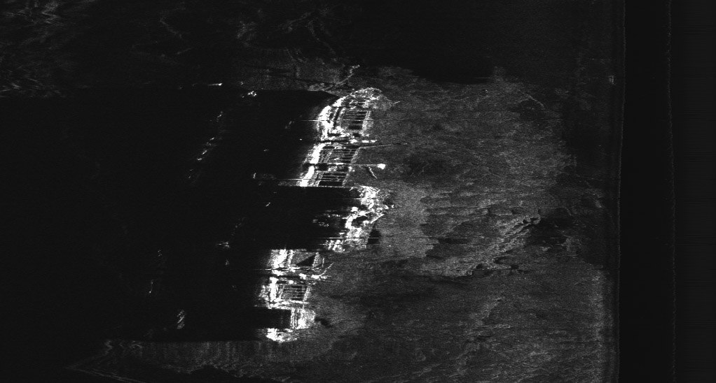
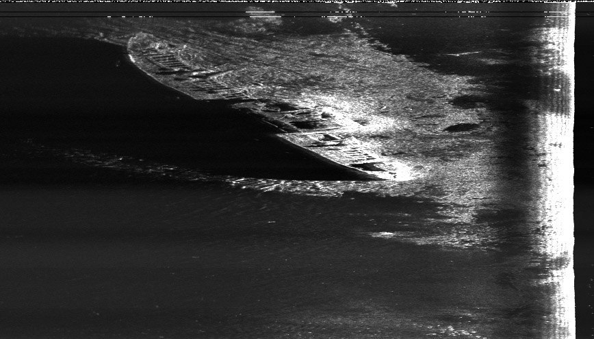
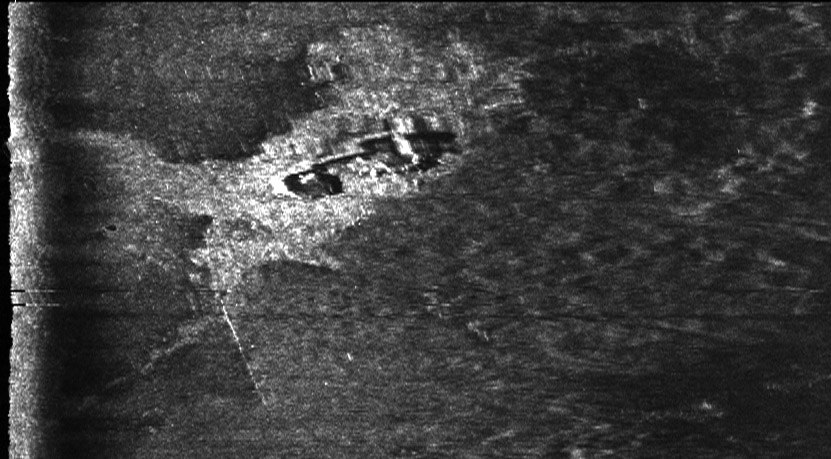
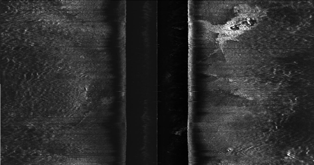
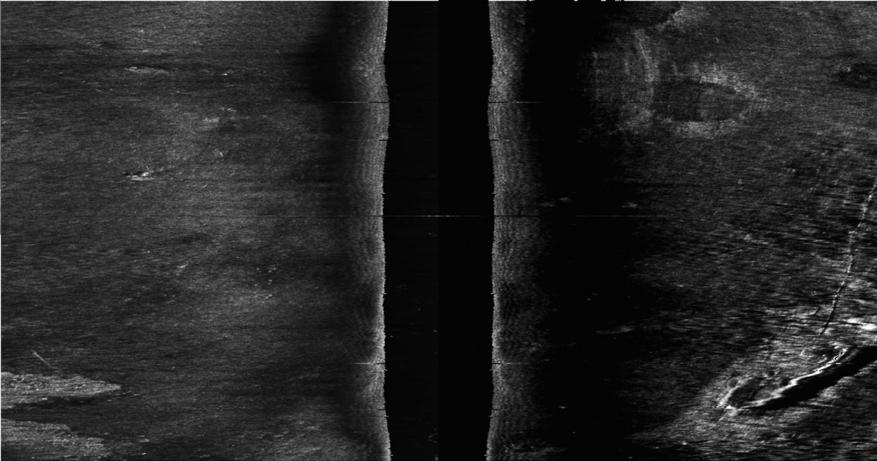
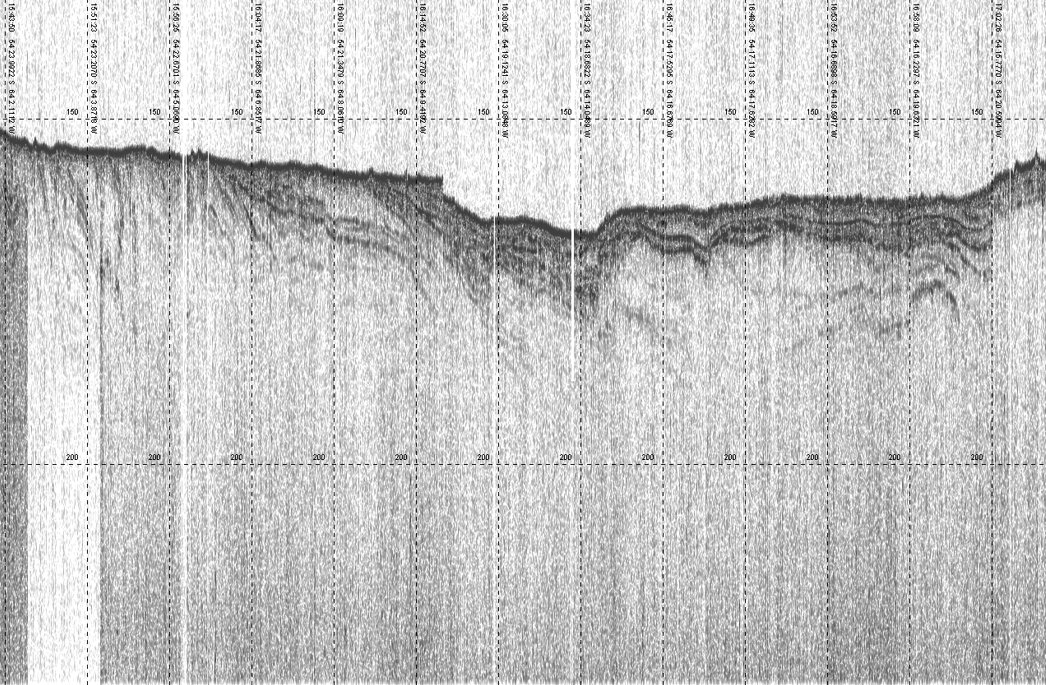
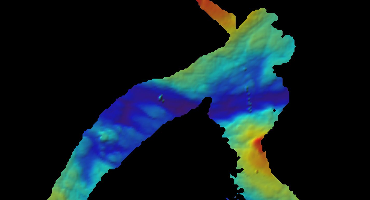
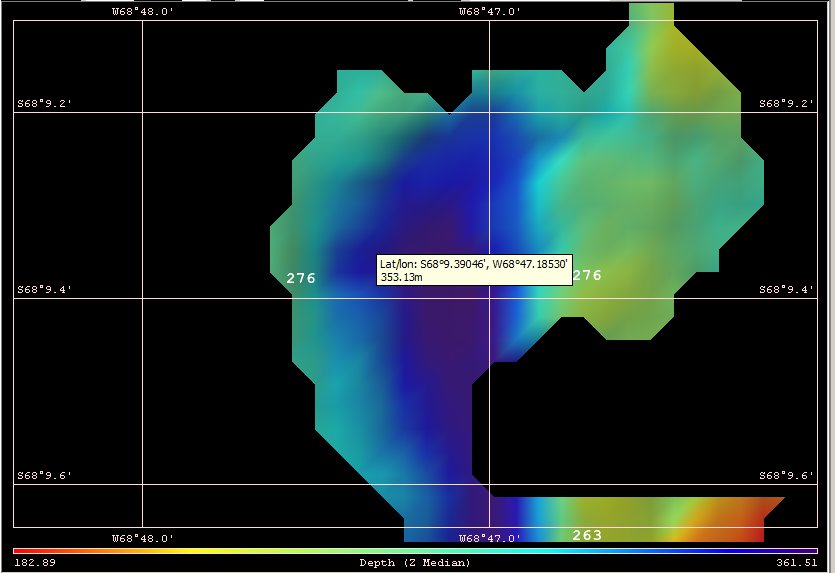
HYDROGRAPH LTD provides professional hydrographic surveys, bathymetric mapping, seabed investigation, navigation safety assessments, and marine data processing. From field measurements to final chart-ready deliverables.

15+
Years Experience
200+
Survey Missions
6
Survey Platforms
0.1 m
Mapping Accuracy
// What We Do

Full-cycle hydrographic survey.

From field measurements and positioning control to bathymetric processing, seabed interpretation, chart production, and technical reporting.

01

Hydrographic Surveys

Professional single-beam and multibeam bathymetric surveys for ports, coastal zones, rivers, lakes, engineering sites, and navigation channels.

02

Bathymetric Mapping

Accurate depth models, contour maps, seabed relief visualisation, and digital terrain models prepared for engineering and navigation tasks.

03

Navigation Safety Assessment

Survey and documentation of approaches, fairways, berths, underwater hazards, shallow areas, and critical zones affecting safe vessel movement.

04

Seabed & Object Investigation

Detection, positioning, and documentation of seabed features, debris, underwater objects, anomalies, and engineering constraints.

05

Marine Data Processing

Cleaning, correction, interpretation, visualisation, and integration of hydrographic, geodetic, acoustic, and cartographic datasets.

06

Technical Reporting

Clear survey reports, charts, profiles, coordinate tables, GIS-ready deliverables, and documentation for clients, engineers, and authorities.

Reliable measurements
for marine decisions.

Hydrography is the foundation of safe navigation, responsible engineering, port development, dredging control, coastal planning, and underwater infrastructure projects.

HYDROGRAPH LTD combines field survey practice, positioning control, bathymetric data, and cartographic interpretation into clear deliverables that engineers, vessel operators, and authorities can use with confidence.

Our workflows integrate multibeam echosounder, single-beam sounder, sub-bottom profiler, and positioning data into a single co-registered dataset — enabling detailed analysis of seabed morphology, depth variations, sediment structure, and underwater features.

All surveys are conducted to IHO S-44 standards and delivered in client-ready GIS, CAD, and cartographic formats. From port inspections to open-water bathymetric campaigns — precision from first sounding to final chart.

Hydrographic data transformed
into reliable maps.

We convert field measurements into practical cartographic products: bathymetric charts, depth contours, seabed models, survey plans, profiles, and technical documentation.

Our cartographic output covers the full spectrum of hydrographic deliverables — from engineering survey drawings and dredging control grids to official nautical chart supplements and GIS/CAD-ready data packages. Every chart-ready product is validated against source data, georeferenced, and documented for client use.

TASK 01

Bathymetric Charting

Full-coverage depth surveys using calibrated multibeam and single-beam echo sounders. Production of depth contours, digital terrain models, and chart-ready bathymetric products.

TASK 02

Port & Harbour Inspection

High-resolution mapping of berths, quay walls, breakwaters, and approach channels. Dredging volume calculations, sedimentation monitoring, and infrastructure documentation.

TASK 03

Navigation Channel Survey

Survey and documentation of fairways, waterway profiles, sounding lines, and navigational constraints. Deliverables formatted for navigational planning and port authority use.

TASK 04

Pipeline & Cable Route Survey

Pre-lay route assessment and as-built surveys for submarine pipelines and cables. Detection of free spans, crossings, and burial depth using acoustic and sub-bottom methods.

TASK 05

Coastal Zone Mapping

Seabed classification and coastal morphology mapping for engineering impact assessment, coastal zone planning, and shoreline change monitoring using acoustic and positioning data.

TASK 06

GIS / CAD Deliverables

Structured, client-ready output in GIS and CAD formats. Coordinate tables, survey grids, track plots, depth models, and technical documentation for engineering and planning use.

Bathymetric survey chart with depth contours
Bathymetry · Contours

Bathymetric Survey & Depth Model

Sounding lines, depth contours, and seabed relief visualisation.

Navigation instruments and survey tools
Survey · Instruments

Survey Equipment & Positioning

Precision instruments for field measurements and data acquisition.

Hydrographic field survey operations
Field Operations

Field Survey Operations

Equipment deployment and data acquisition during active survey.

Marine cartography and navigation chart
Marine Cartography
⚓ Navigation Safety

Sub-bottom & depth data.

Sub-bottom profiler records and multibeam bathymetric models from survey operations.

Sub-bottom Seismic Profile
SBP · Sub-bottom

Sub-bottom Seismic Profile

High-resolution sub-bottom profiler (SBP) record showing sediment layering and acoustic stratigraphy. Depth scale to ~200 m.

Multibeam Bathymetric Model
MBES · Bathymetry

Multibeam Bathymetric Model

Colour-coded depth model derived from multibeam echosounder data. Warm tones indicate shallow areas; cool tones represent deeper zones.

From raw measurements
to usable hydrographic products.

HYDROGRAPH LTD processes field data into verified, structured, and client-ready deliverables for engineering, navigation, and marine planning.

Processing · QC · Delivery
HYDROGRAPH LTD
Hydrographic Data Processing
Survey Data Cleaning

Systematic noise filtering, tide correction, sound velocity profile application, and outlier removal from raw sounding data to produce verified depth measurements.

Bathymetric Model Generation

Construction of digital terrain models, seabed relief grids, and depth surface products from processed sounding data. Resolution from 0.1 m to survey-area scale.

Contour & Chart Production

Generation of depth contours, isobaths, sounding plans, and chart-ready cartographic products from bathymetric datasets compliant with IHO S-44.

GIS / CAD Deliverables

Structured export to GIS layers, CAD drawings, coordinate tables, and technical documentation packages ready for client engineering and planning workflows.

From brief to bathymetric chart.

A structured hydrographic workflow — validated, publication-ready deliverables every time.

01

Requirements

Define survey area, depth range, accuracy spec, and deliverable format.

02

System Setup

Sensor selection, vessel mounting, sound velocity profiling, and calibration.

03

Acquisition

Survey execution with real-time QC, positioning control, and data logging.

04

Processing

Cleaning, filtering, georeferencing, and bathymetric model generation.

05

Deliverable

Charts, depth models, GIS layers, profiles, and technical report.

Bathymetric & sub-bottom data.

Multibeam echosounder depth models, sub-bottom profiler records, and calibration data from active hydrographic survey operations.

Bathymetric Survey — Station 3
MBES · Bathymetry

Bathymetric Survey — Station 3

Multibeam echosounder depth model showing seabed relief with colour-coded depth scale. Survey area with georeferenced sounding data.

Black Spots — Rocky Seabed Features
MBES · Seabed

Black Spots — Rocky Seabed Features

Multibeam bathymetric model revealing rocky seabed features and hard substrate zones. Depth contours and acoustic backscatter analysis.

Multibeam Patch Test — Calibration
MBES · Calibration

Multibeam Patch Test — Calibration

Seafloor Information System calibration procedure. Roll, pitch, heading, and time-delay offsets applied across intersecting survey lines.

Layer Matching — Line Crossings
MBES · Processing

Layer Matching — Line Crossings

Survey line crossings and layer matching analysis. Depth profile comparison between intersecting passes for quality control.

Sub-bottom Profile — Sediment Column
SBP · Sub-bottom

Sub-bottom Profile — Sediment Column

Sub-bottom profiler record showing sediment layering and acoustic stratigraphy. Reflector geometry and layer continuity analysis.

Sedimentary Infill — Sub-bottom Record
SBP · Stratigraphy

Sedimentary Infill — Sub-bottom Record

Sub-bottom profiler record of sedimentary infill sequence. Clear acoustic reflectors indicate layered sediment architecture.

Sub-bottom Profile — Survey Line
SBP · Sub-bottom

Sub-bottom Profile — Survey Line

High-resolution sub-bottom profiler transect. Acoustic reflectors and sediment thickness estimation along survey track.

Sub-bottom Profile — Transect
SBP · Sub-bottom

Sub-bottom Profile — Transect

Sub-bottom profiler record from survey operations. Sediment column and basement reflector geometry visible.

Sub-bottom Close-up — Fine Detail
SBP · Close-up

Sub-bottom Close-up — Fine Detail

Close-up sub-bottom profiler record showing fine-scale sediment structure. High-resolution acoustic reflectors and layer contacts.

Sub-bottom Profile — Survey Pass
SBP · Sub-bottom

Sub-bottom Profile — Survey Pass

Sub-bottom profiler transect with clear sediment layering. Acoustic facies analysis and reflector continuity assessment.

Sub-bottom Profile — Full Section
SBP · Sub-bottom

Sub-bottom Profile — Full Section

Full sub-bottom profiler section. Sediment stratigraphy, reflector geometry, and layer thickness data.

Need a hydrographic survey?

Let's discuss your project, survey area, required accuracy, deliverables, and timeline. We'll respond within one business day.

info@hydrograph.com.ua